
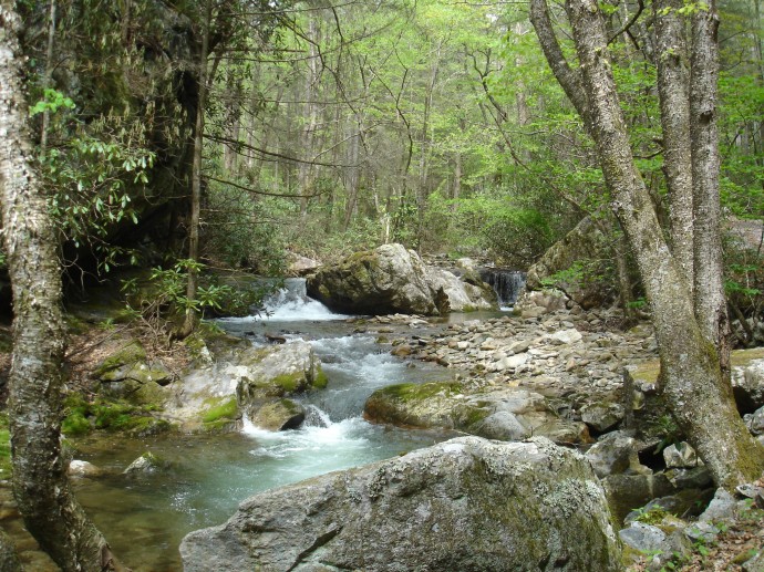
Rocky Fork Creek
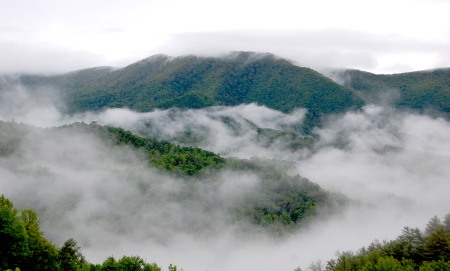
Mist rising in the Rocky Fork watershed.
Today we celebrate Earth Day with the closing of an exciting new project which will enable more people to learn about and enjoy the incredible Rocky Fork region!
We worked with the Tennessee Department of Environment and Conservation to purchase a 1-acre tract to facilitate public access for Rocky Fork State Park.
“This 1-acre tract is a critical acquisition because it contains the only public access into Rocky Fork State Park,” said SAHC Executive Director Carl Silverstein. “We are proud to have been able to work with the State of Tennessee and other partners over the past decade to conserve the 10,000-acre Rocky Fork watershed. This recent acquisition is an integral part of these efforts, as it will afford public access for visitors to enjoy trails and trout streams in this stunning area.”
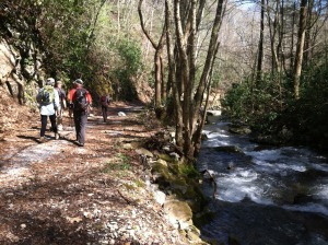
Hiking along Rocky Fork Creek.
Rocky Fork State Park lies within a half mile of the Appalachian Trail and contains a system of existing and planned public trails for hiking, mountain biking and horseback riding, including a future connection to the Appalachian Trail. The park also contains pristine mountain streams, including Rocky Fork Creek, Flint Creek, South Indian Creek and the headwaters of Long Branch. The main branch of Rocky Fork, designated as a TN Exceptional Stream, flows through the recently acquired 1-acre tract. These streams are home to native Southern Appalachian Brook Trout and are available to the public for fishing.
The 2,036-acre State Park, together with approximately 8,000 adjoining acres now owned by the US Forest Service, comprise the 10,000-acre Rocky Fork watershed. SAHC worked from 2006-2012 to protect this iconic area, in partnership with the Appalachian Trail Conservancy (ATC), The Conservation Fund (TCF), the State of Tennessee, the U.S. Forest Service, and other public and private partners. The Tennessee Heritage Conservation Trust Fund provided $6 million for the State of Tennessee to acquire the land for the Park, which was officially designated Tennessee’s 55th State Park in October 2012.
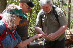
David Ramsey (right) leads an SAHC guided group hike into Rocky Fork.
“The partnership between the Southern Appalachian Highlands Conservancy and Tennessee State Parks has been pivotal to preserve and protect the unique and critical tracts of land in the southern Appalachian Mountains,” said Park Manager Jesse Germeraad. “This 1-acre tract is very important, because it provides Rocky Fork State Park, visitors, and Appalachian National Scenic Trail hikers access to the beautiful and pristine natural and historical resources Rocky Fork State Park and the Cherokee National Forest has to offer in the Rocky Fork Watershed. We are looking forward to the continued support and partnership we have with the Southern Appalachian Highlands Conservancy.”
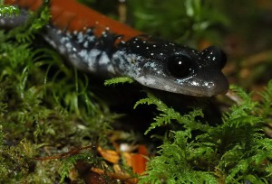
Yonahlossee salamander, photo courtesy David A. Ramsey.
Several federally listed endangered species can be found within Rocky Fork State Park. The diverse cove forest is home to the Peregrine Falcon, the Yonahlossee Salamander, and the Woodland Jumping Mouse, as well as many native wildflowers. The property is also part of the Unicoi Bear Sanctuary and lies within an Audubon Important Bird Area.
Currently there is very limited parking. Long-term goals for the newly acquired 1-acre parcel at the Park entrance include improvements for an expanded parking area and visitor center.


