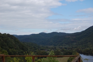
On December 28, SAHC recorded a conservation easement on 112 acres of land in Madison County, near the Cherokee and Pisgah National Forests.
“The Plateau is remarkable because it fills an immensely significant gap between the Cherokee National Forest and the Pisgah National Forest. One of our primary focuses is to protect  land adjacent to State and National Forests; thus, to secure a tract of land that bridges two National Forests is a spectacular accomplishment,” said Carl Silverstein, SAHC Executive Director.
As another SAHC-held conservation easement that is highly visible to the public, the Plateau project helps secure the scenic landscape for outdoor recreation enthusiasts, visitors, and residents of Western North Carolina. The Plateau property can be seen from the French Broad River, Appalachian Trail, and the Dixie Highway.
The Plateau also lays in close proximity to five Natural Heritage Areas: Lower French Broad Aquatic Habitat, Paint Rock Road Natural Area, Davis Branch Floodpain, Mine Ridge, and Murray Branch Slopes.
With approximately 17,610 feet of streams on the property, the conservation easement will positively affect water quality of the Lower French Broad River.


Wowsers! You guys really get the job done! Great work!